1Canoe-no-sato Ochi
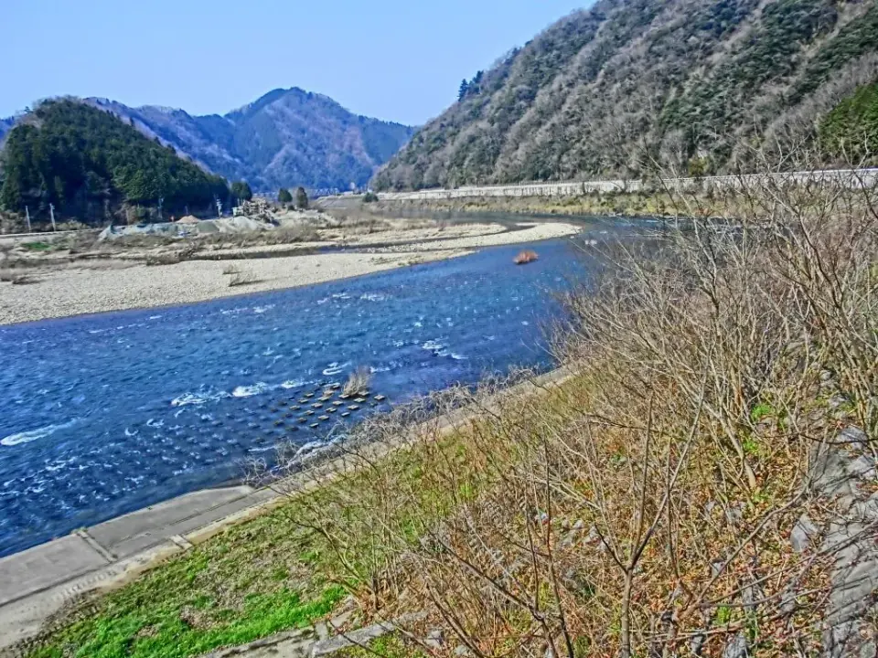
Iwami Winery Canoe no Sato Ochi in Kamemura offers canoeing and kayaking on the Gonokawa River. Combine it with camping or a trailer-house stay. Water levels and weather may change the activities available.
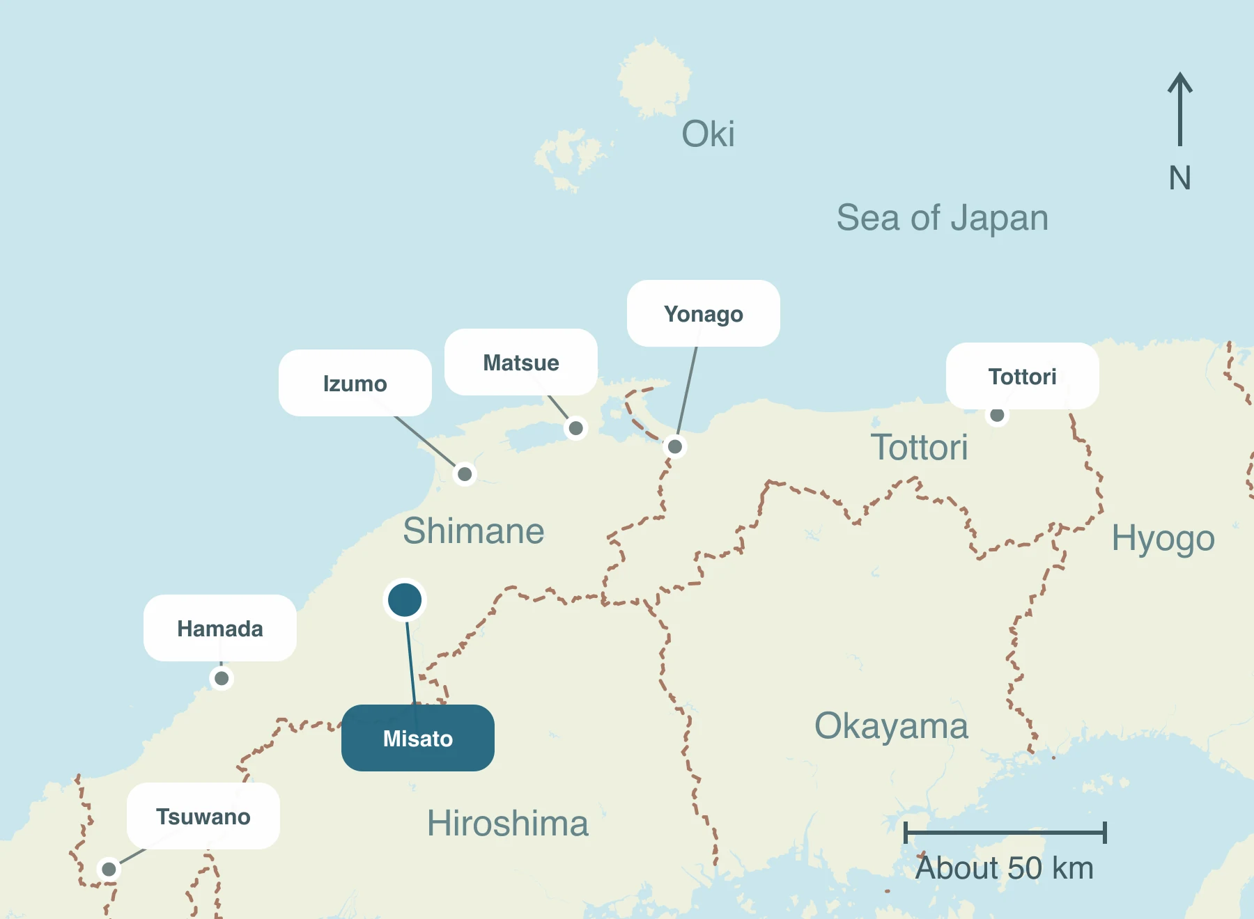
Misato TownEnjoy the Go River and mountain landscapes, day-use hot springs and river activities in Misato, Shimane. Plan the Kasubuchi and southern Daiwa areas separately, with Ochi Yamakujira wild-boar dishes, produce markets, accommodation and stops around local events.
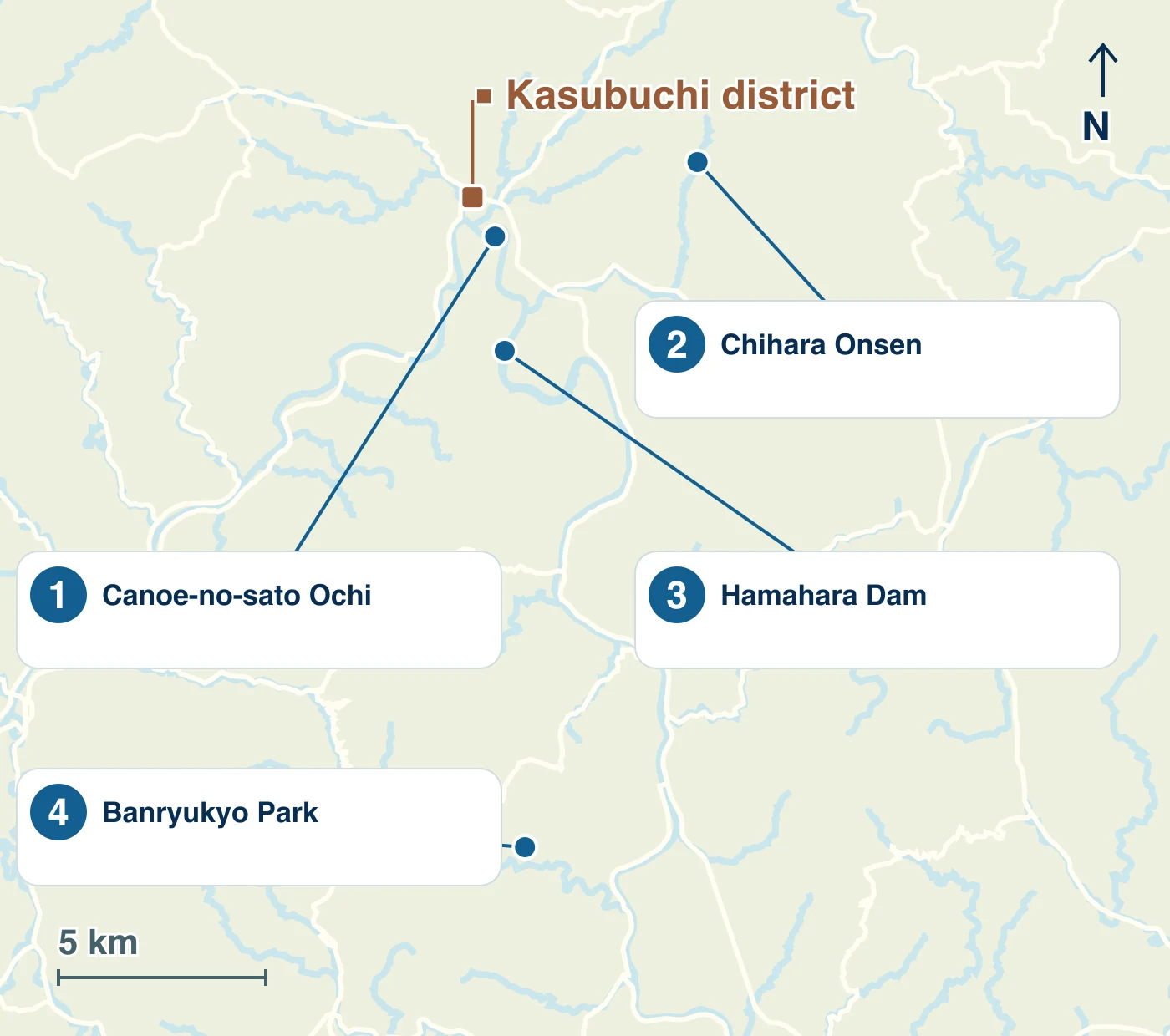
From Kasubuchi, visit Hamahara Dam, Canoe no Sato and Chihara Onsen to the east. Banryukyo Gorge and the southern roadside station require another journey. The Sanko Line has closed, so explore by bus or car.
Iwami Winery Canoe no Sato Ochi in Kamemura offers canoeing and kayaking on the Gonokawa River. Combine it with camping or a trailer-house stay. Water levels and weather may change the activities available.
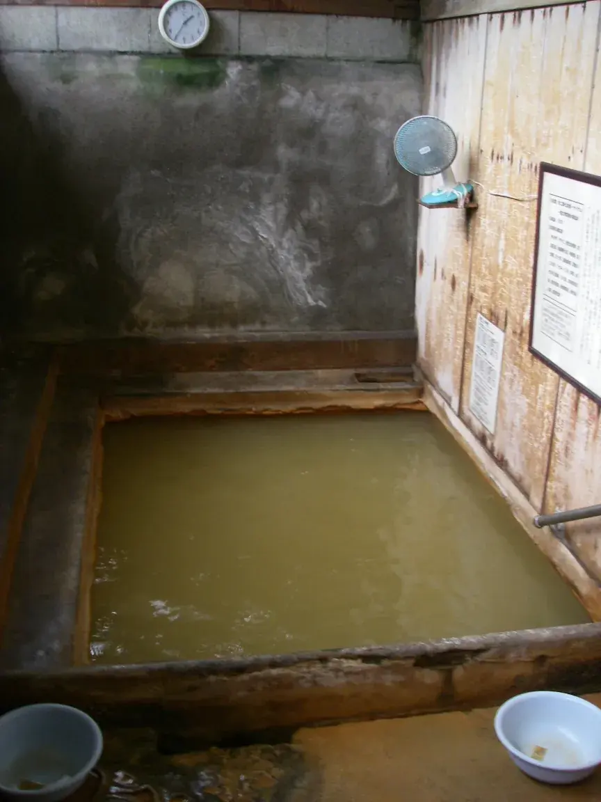
A day-use hot spring reached by mountain roads. Its wooden bath and water rising from beneath your feet are distinctive. It currently does not offer accommodation.
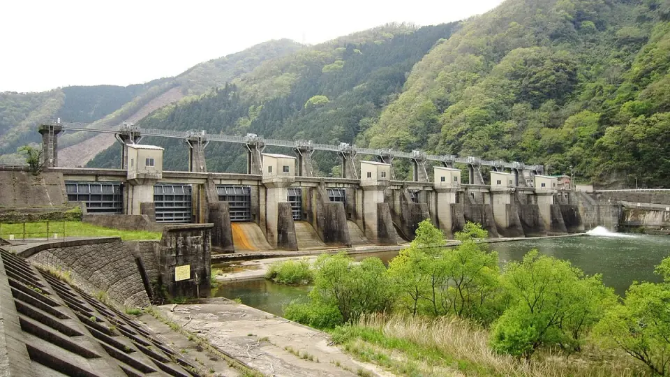
A hydroelectric dam across the middle Gonokawa River. View its gates, river and surrounding mountains to explore the relationship between the river and local life. Stay out of restricted management areas and view from public places.
A walking destination among water and greenery in Muranogo. Follow the paths for waterfall and gorge scenery. It lies away from the Kasubuchi area.
Approximate one-way times to each arrival point. Driving times vary with breaks and traffic; public transport depends on services and transfers.
About 2 hr
Via expressways
Route and timetable sourcesAbout 2 hr
Route and timetable sourcesAbout 1 hr 18 min
Bihoku Kotsu Sakugi bus route
Example weekend/holiday service: 9:09 → 10:27. Travel to northern areas such as Kasubuchi is additional.
Route and timetable sourcesTake a scheduled bus from Oda toward Kasubuchi, or drive via Route 375 and other roads. Combine a car or town buses to explore sights spread between north and south. The Sanko Line no longer operates.
Check event dates and venues as you plan your visit. This guide features recommended events.
 縁側サロン「二人静」2026秋6 days left〜Oct 13 (Tue) Daily 10:00–15:00Misato Town · 縁側サロン「二人静」Admission charges apply; check prices and conditions in the details.Official names & details are in Japanese
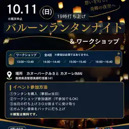
 第41回 鴨山駕籠かき大会This weekOct 10 (Sat) 12:00–13:10Misato Town · カヌーパークみさと カヌーレIMAIAdmission charges apply; check prices and conditions in the details.Official names & details are in Japanese
Enjoy them between sightseeing stops, and take some home as gifts.
Soramame in Kubo introduces hamburger steaks made from Misato's Ochi Yamakujira wild boar meat, a meal that showcases local resources.
Eat locally: Yamakujira means wild boar here, not whale. Taste the rural hills through dishes such as hamburger steaks using local meat.
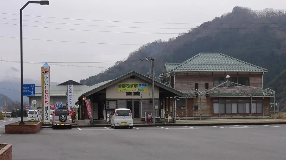
Cafe Green Road at Green Road Daiwa Roadside Station offers lunches using local rice and vegetables. The adjacent farm shop sells produce and specialties.
Eat locally: Have a lunch of local rice and vegetables during a Gonokawa riverside break.
Take home: Choose seasonal vegetables and local products to suit how much you can carry and their storage needs.
For a quiet hot-spring stay, consider Nakamura Ryokan in Yugakai.
For a quiet hot-spring stay, consider Nakamura Ryokan in Yugakai. Overnight stays and day visits with lunch require advance reservations. Bath-only day visits are not offered.
For a stay overlooking the Gonokawa River, consider Iwami Winery Hotel Misato, where all rooms have river views.
For a stay overlooking the Gonokawa River, consider Iwami Winery Hotel Misato, where all rooms have river views. The former Ushio Station cannot be used for current rail access.
Find local kagura performances and festival schedules on the tourism association's dedicated website.
Official event informationEnjoy Gonokawa riverside scenery, from spring mountain flowers to autumn leaves, alongside local activities.
Official event information