

Tottori City
Tottori City flavours
Sand-dune shallots and pears · Karo port seafood
Explore food and gifts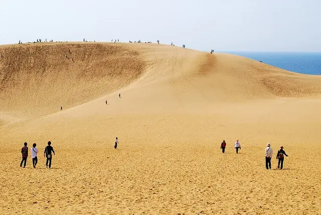 Tottori Sand Dunes
Use Tottori Station as your base for the dunes, Uradome Coast and the historic post towns of Chizu and Wakasa.
Events for your travel dateTottori City · Sand dunes and scenic viewsOfficial ↗
Vast sand dunes facing the Sea of Japan. Climb the Umanose ridge for sweeping views of sand and sea.
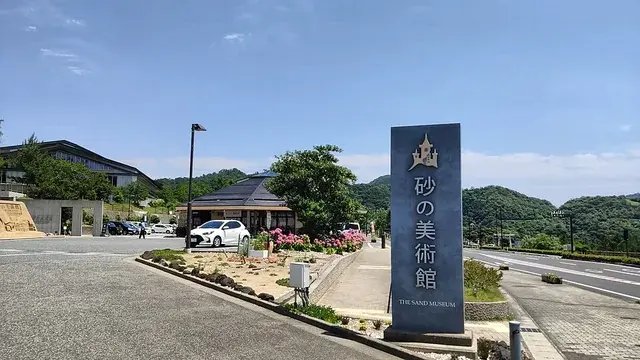
Tottori City · Museum and sand sculpturesOfficial ↗
A museum of sculptures made only from sand and water. Its annual themed exhibition takes visitors on a journey around the world through sand art.
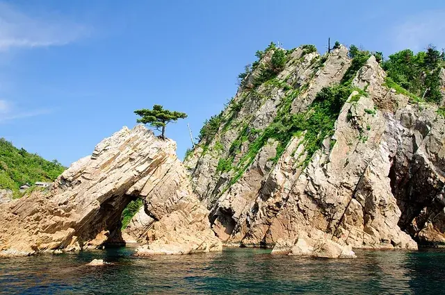
Iwami Town · Coast and geoparkOfficial ↗
Part of the San'in Kaigan Geopark, with rocky islands and clear water to admire from a sightseeing boat.
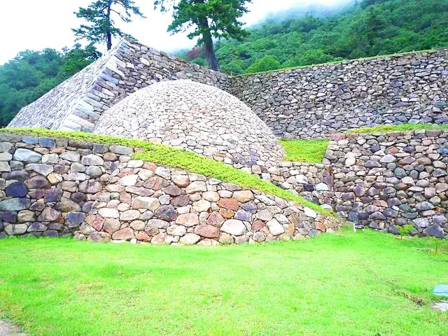
Tottori City · Castle ruins and stone wallsOfficial ↗
The ruins of a castle built on Mount Kyusho. Its spherical maki-ishigaki stonework is unique in Japan.
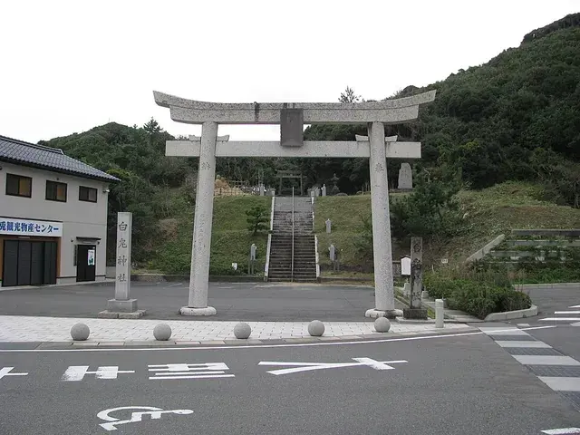
Hakuto, Tottori · Shrine & connectionsOfficial ↗
A shrine associated with the White Rabbit of Inaba legend. White rabbit statues line this place known for bringing people together.
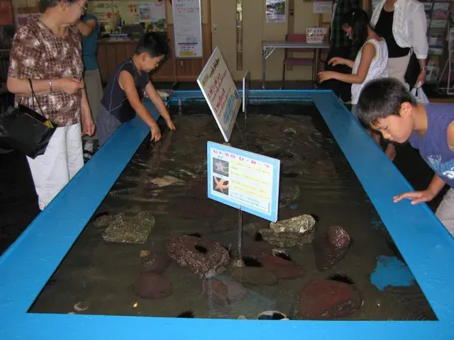
Karo, Tottori · Aquarium and crabsOfficial ↗
A crab-focused aquarium with Matsuba snow crabs, Japanese spider crabs and more. Admission is free.
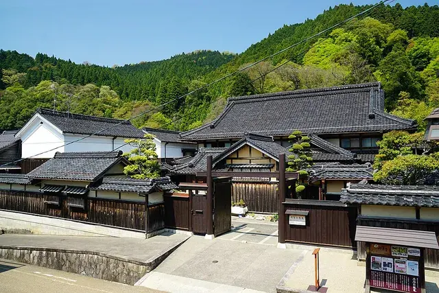
Chizu Town · Historic post town and streetsOfficial ↗
A historic post town on the Inaba road. The Ishitani Residence, an Important Cultural Property, has more than 40 rooms and an impressive garden.
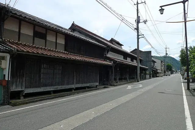
Wakasa Town · Historic post town and storehousesOfficial ↗
A historic post town with storehouses along roughly 300 meters of Kura-dori Street and continuous kariya eaves built to shelter people from snow.
Travel times to Tottori (Rail)
Schematic map; approximate one-way times checked against official guides and route searches. Tap a place label for details. Map data: © OpenStreetMap contributors
The Super Hakuto runs direct to Tottori from Osaka and Kyoto, and the Super Inaba from Okayama. From Tokyo or Nagoya, take the Shinkansen to Himeji or Okayama and transfer to a limited express.
Tottori tourism website: access ↗The airport bus to Tottori Station takes about 20 minutes. Flights operate only to and from Haneda.
Tottori Sand Dunes Conan Airport ↗Nihon Kotsu highway buses connect Osaka and Kobe with Tottori, departing from Umeda, Namba and Sannomiya. There are also routes from Himeji and Kyoto. There is currently no overnight bus from Tokyo.
Nihon Kotsu: Tottori–Kobe–Osaka bus route ↗Car: About 20 min / Local bus (Tottori Sand Dunes route and others) About 20 min
Buses toward the sand dunes leave from the terminal outside Tottori Station and take about 20 minutes. The Kirin Jishi sightseeing loop bus also runs on weekends and public holidays. Destination: Tottori Sand Dunes.
Tottori Station and Airport to Tottori Sand Dunes (Tottori tourism website) ↗Car: About 30 minutes / JR train and walking About 50 min
Take the JR San-in Line to Iwami Station (about 23 minutes), then walk about 27 minutes. A local bus from Iwami Station takes about 10 minutes. Destination: Uradome Coast.
Route and timetable (NAVITIME) ↗Car: About 30 minutes / JR limited express and walking About 40 min
Take the Super Hakuto or Super Inaba limited express to Chizu Station (about 30 minutes), then walk about 10 minutes. Destination: Ishitani Residence (Chizu-juku).
JR Tottori Station timetable (JR Odekake Net) ↗Car: About 20 min / Airport bus About 20 min
The airport bus between Tottori Station and the airport takes about 20 minutes (adult fare ¥480). Departures from the airport are timed to arriving flights. Destination: Tottori Sand Dunes Conan Airport.
Tottori Sand Dunes Conan Airport: bus access ↗Car: About 4 hr / Limited express About 3 hr 10 min
Includes toll roads. Rail times are approximate for Direct limited express.
Routes from Hamada ↗Car: About 2 hr 40 min / Limited express About 2 hr
Includes toll roads. Rail times are approximate for Direct limited express.
Routes from Izumo ↗Car: About 2 hr 10 min / Limited express About 1 hr 30 min
Includes toll roads. Rail times are approximate for Direct limited express.
Routes from Matsue ↗Car: About 1 hr 40 min / Limited express About 1 hr 10 min
No toll sections. Rail times are approximate for Direct limited express.
Routes from Yonago ↗Car: About 50 min / Limited express About 30 minutes
Check with the route planner. Rail times are approximate for Direct limited express.
Routes from Kurayoshi ↗Times are approximate and one way. Waiting, traffic and cancellations may affect your journey.


Try regional food and pick up local gifts between visits to the sights.
Sand-dune shallots and pears · Karo port seafood
Explore food and gifts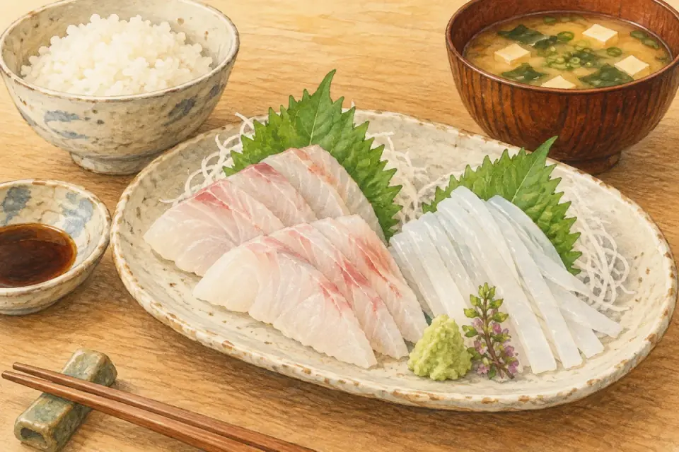
Try seafood by the port · Seasonal Iwami specialities
Explore food and gifts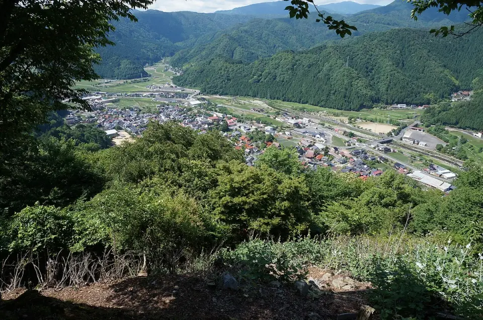
Books and soba at Torinosu · Local food at Michi-no-Eki Wakasa
Explore food and gifts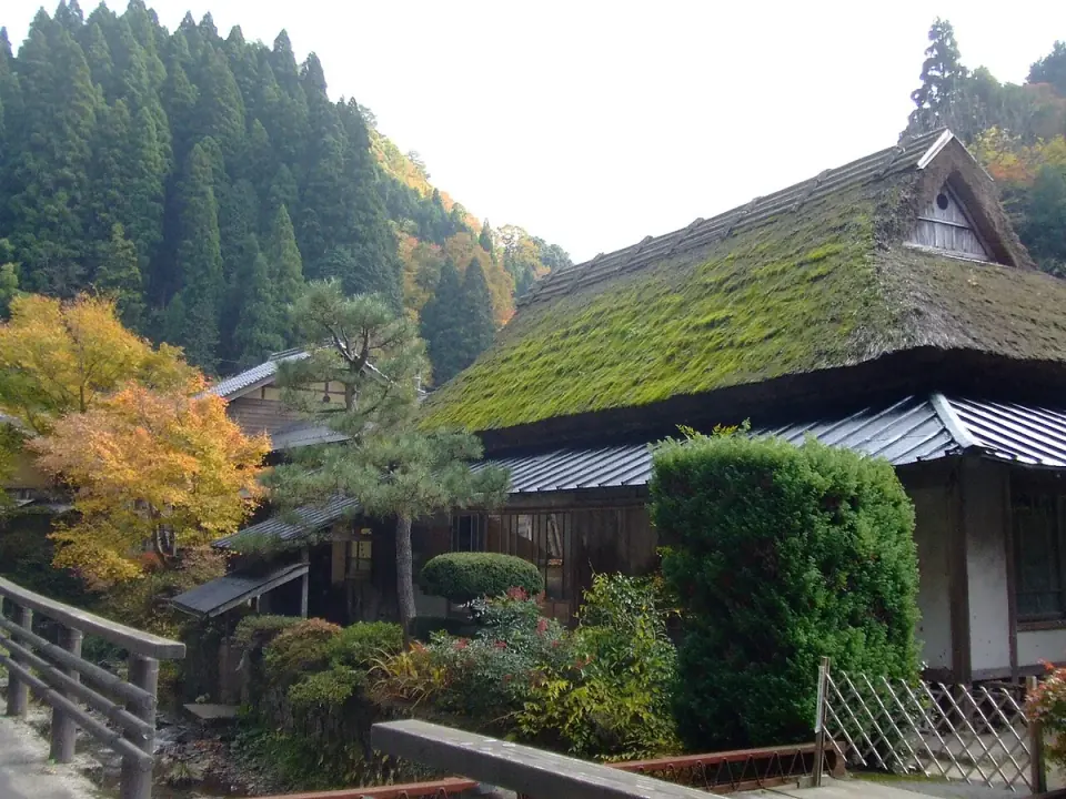
Regional food in Itaihara's old houses · Suwaizumi and Chizu's sake breweries
Explore food and gifts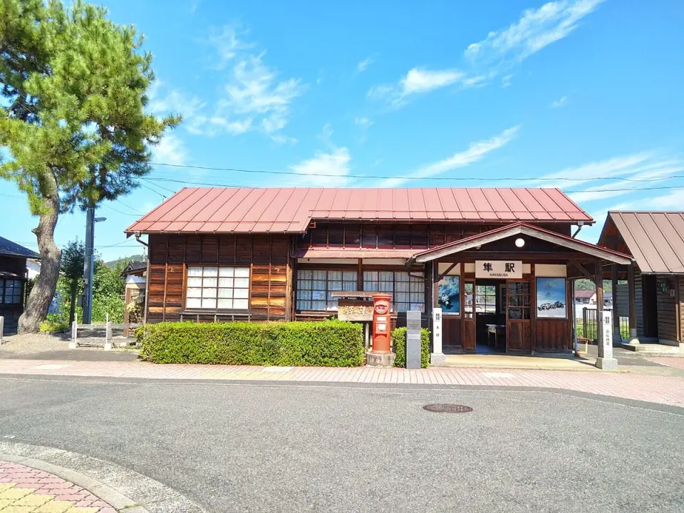
Tenbi eggs and dining at Oenosato · Koge Hanagosho persimmons and seasonal fruit
Explore food and giftsIngredients are seasonal, and availability varies by shop. Ask the seller about shelf life, refrigeration and shipping.
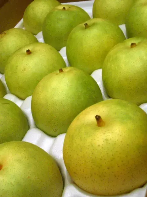
Nijisseiki pear variety example; not a product or location in Tottori City.: akira yamada / Wikimedia Commons · CC BY-SA 2.0(converted to WebP, resized and cropped to fit)
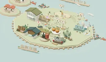
AI-generated illustration; not a photograph of a particular shop, product or menu.: 本サイト制作(OpenAI ImageGen) · Site-created asset(converted to WebP, resized and cropped to fit)
Wakasa's townscape seen from Onigajo Castle Ruins: Reggaeman / Wikimedia Commons · CC BY-SA 3.0(converted to WebP, resized and cropped to fit)
Itaihara village, with a cafe in a traditional house: As6022014 / Wikimedia Commons · CC BY 3.0(converted to WebP, resized and cropped to fit)
Hayabusa Station, a stop on a day out in Yazu: Sashimiteishoku / Wikimedia Commons · CC0(converted to WebP, resized and cropped to fit)
Check accommodation details and prices on the booking site.
Check each restaurant's opening hours and closing days.
A car makes it easier to explore Uradome Coast, Chizu and Wakasa. Rental branches are available around Tottori Station and at Tottori Sand Dunes Conan Airport.
Combine nearby regions in your itinerary. Tap a label to open that regional guide.
AirportApproximate one-way driving times from Tottori Station to each region's main station. Map data: © OpenStreetMap contributors
Choose a town by its location and main sights.
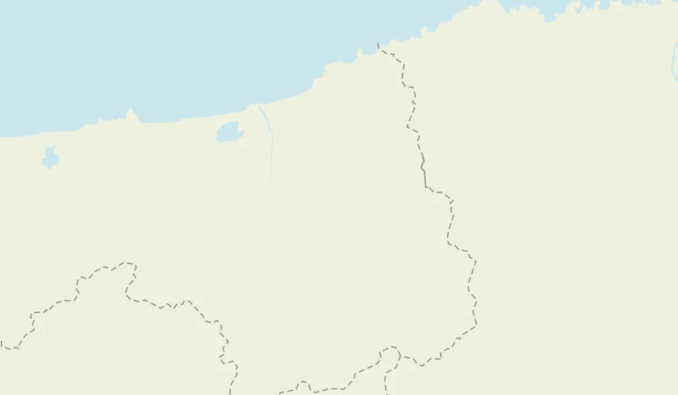
Points mark representative sights, not town boundaries or centres. Dashed lines are prefectural borders.
Terrain: © OpenStreetMap contributors (ODbL) / OpenFreeMap.
Walk across rolling dunes towards the sea, with sweeping views from the Uma-no-se ridge. Walking on sand takes longer than on a paved path, so plan your time according to whether you want a quick view or a longer walk.
Hashi photo · CC BY-SA 3.0(converted to WebP, resized and cropped to fit)
Map data: © OpenStreetMap contributors · OpenFreeMap / OpenMapTiles